How bridges get built · Site investigation and testing · Geophysical surveys
Also called: seismic refraction, electrical resistivity, MASW, marine sub-bottom profiling
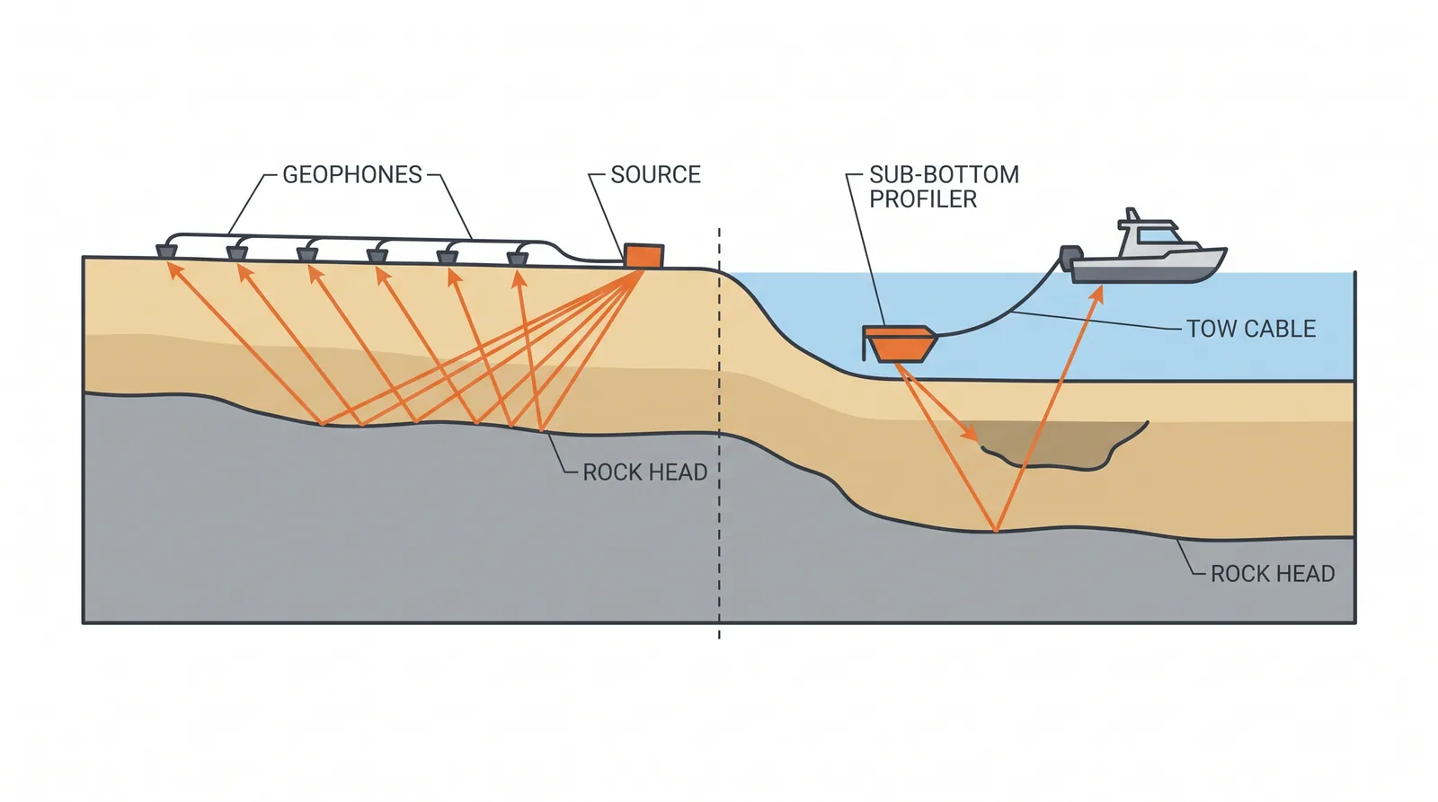
How it is done
- On land, run seismic refraction or MASW lines along the alignment to map rock head and stiffness; electrical resistivity tomography for cavities and moisture.
- On water, tow a sub-bottom profiler and side-scan sonar to map sediment thickness, buried channels and debris.
- Calibrate the sections against boreholes, then extend the ground model between them.
Where it fits
- Long alignments, karst, buried channels, marine sites before the drilling campaign.
- Sites where access for rigs is limited.
Where it does not
- Using geophysics as the only evidence for a foundation level.
Plant, pace and money
PlantGeophones and a seismic source, resistivity cables, survey boat with profiler.
ProductivityKilometres per day on land; several line-kilometres per day at sea.
CostLow per metre; a few percent of the investigation budget.
Risks and controls
What goes wrong
- Ambiguous inversions; a thin hard layer over soft can hide the soft.
Quality assurance
Calibration boreholes at line intersections; interpretation reported with confidence levels.
Examples
Sub-bottom profiling is routine before marine bridge investigations in the Gulf and Southeast Asia.
Related methods
Further reading
ASTM D5777 (seismic refraction) · ASTM D6431 (resistivity)